Kocs
Kocs is a village in Komárom-Esztergom county, Hungary. It lies west of Tata and 65 km north-west of Budapest. A site of horse-drawn vehicle manufacture from the 1400s, the name is the source of the word coach and its equivalent in other languages such as: Czech kočár, Slovak koč, German Kutsche, Dutch koets, Catalan cotxe, Italian cocchio, Spanish, Portuguese, and French coche, Scandinavian kusk, and Serbian кочија (kočija).
During the reign of King Matthias Corvinus in the 1400s, the wheelwrights of Kocs began to build a cart with steel-spring suspension. This "cart of Kocs" as the Hungarians called it (kocsi szekér) soon became popular all over Europe. The spread of the kocsi szekér has been linked by some theories personally to the king of Hungary Ferdinand I, the younger brother of Charles V who became the king of Spain, Emperor of Germany, and lord of the Burgundian Netherlands, in the 16th century, and who promoted the comfortable, spring-suspended wagons among the wealthy European nobility. A 16th-century German depiction of a kocsi without springs puts this theory in doubt, however, and it is uncertain whether the springs or some other feature were responsible for the spread of the word throughout Europe. The Thurn-und-Taxis-Post, the imperial post service, employed the first horse-drawn mail coaches in Europe since Roman times in 1650 –, as they started in the town of Kocs the use of these mail coaches gave rise to the term "coach". In contemporary colloquial Hungarian the word "kocsi" is most often used to mean "car".
The coat of arms of the town, in addition to displaying a ram and the Árpád stripes, also depicts an early model cart or wagon that refers to the wheelwrights' successful industry.
Map - Kocs
Map
Country - Hungary
 |
 |
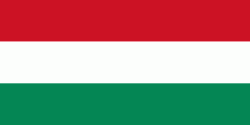
| Flag of Hungary | |
The territory of present-day Hungary has for centuries been a crossroads for various peoples, including Celts, Romans, Germanic tribes, Huns, West Slavs and the Avars. The foundation of the Hungarian state was established in the late 9th century AD with the conquest of the Carpathian Basin by Hungarian grand prince Árpád. His great-grandson Stephen I ascended the throne in 1000, converting his realm to a Christian kingdom. By the 12th century, Hungary became a regional power, reaching its cultural and political height in the 15th century. Following the Battle of Mohács in 1526, it was partially occupied by the Ottoman Empire (1541–1699). Hungary came under Habsburg rule at the turn of the 18th century, later joining with the Austrian Empire to form Austria-Hungary, a major power into the early 20th century.
Currency / Language
| ISO | Currency | Symbol | Significant figures |
|---|---|---|---|
| HUF | Hungarian forint | Ft | 2 |
| ISO | Language |
|---|---|
| HU | Hungarian language |


